

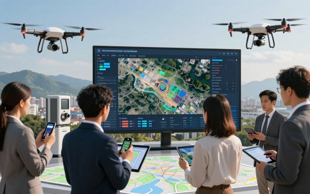
Today, geospatial technologies help us collect, study, show, and understand information about specific places on Earth. They support everyday navigation, environmental studies, and informed decisions through mapping technology.
This article explores geospatial technology examples, including GPS, GIS, remote sensing, LiDAR, drones, satellite imagery, digital mapping, and indoor positioning systems. Each tool has a special purpose, but they often work together to explain our surroundings.
These systems matter in public safety, transportation, agriculture, urban development, and business operations. They use geospatial data to improve how we navigate and interact with the world. Learning about them can lead to better decisions.
Key Takeaways
- Geospatial technologies are vital for location-based data collection and analysis.
- Common tools include GPS, GIS, and remote sensing.
- These systems are interconnected and enhance various sectors.
- Applications range from navigation to environmental monitoring.
- Understanding these technologies can improve decision-making.
What Are Geospatial Technologies and Why Do They Matter?
Geospatial technologies include tools and methods for analyzing and displaying information tied to specific places. This field combines hardware, software, and geographic data to explain spatial relationships and geographic events. Using geospatial technology helps us understand our surroundings and make informed decisions.
Understanding the geospatial technology definition helps explain why these tools matter today. They bring together several parts, including:
- Data Collection: Gathering information through sensors, satellites, and mobile devices.
- Data Management: Organizing and storing geographic data effectively.
- Spatial Analysis: Interpreting data to reveal patterns and relationships.
- Visualization: Displaying data through maps and models for easier understanding.
Defining Geospatial Technology
At its core, geospatial technology collects and studies location-based data. This data can include geographic coordinates, attributes, imagery, and measurements describing the physical world. These elements support spatial analysis, which helps explain urban planning, environmental monitoring, and resource management.
The Role of Geospatial Data in Modern Society
Geospatial data supports decisions across many parts of modern society. Key areas include:
- Emergency Response: Geospatial data helps coordinate rescue efforts during disasters.
- Infrastructure Planning: City planners use this data to design efficient transportation systems.
- Public Health: Tracking disease outbreaks relies on accurate geographic information.
- Logistics: Companies optimize delivery routes using geospatial analysis.
- Conservation: Environmentalists monitor habitats and wildlife populations.
- Retail: Businesses analyze consumer behavior and location trends.
- Government Services: Public agencies use geographic data for resource allocation.
Geospatial data comes from satellites, sensors, mobile devices, field surveys, aerial platforms, and connected infrastructure. Its value depends on several factors:
- Accuracy: High-quality data leads to reliable analyses.
- Data Quality: Consistent and accurate data is essential for effective decision-making.
- Privacy: Ensuring user privacy is crucial when collecting location-based information.
- Interoperability: Systems must work together to share and analyze data effectively.
- Timely Updates: Regular updates ensure that data remains relevant and useful.
Understanding these basic ideas shows the immense potential of geospatial technologies to shape our world.
Related Posts:

What Are Some Examples of Geospatial Technologies?
Geospatial technologies help us understand and interact with our environment. The main geospatial technology categories include positioning, data management, observation, measurement, visualization, and analysis. These categories show how geospatial systems support daily life.
Categories of Geospatial Technologies
Here are some major examples of geospatial technology:
- Global Positioning System (GPS): This technology provides accurate location and time information, enabling navigation and tracking.
- Geographic Information Systems (GIS): GIS is essential for managing and analyzing spatial datasets, allowing users to visualize and interpret data effectively.
- Remote Sensing: This technology observes the Earth without direct contact, using satellites and aerial sensors to gather data.
- Light Detection and Ranging (LiDAR): LiDAR generates detailed three-dimensional measurements, often used in topographic mapping.
- Unmanned Aerial Vehicles (UAVs): Drones equipped with cameras and sensors collect data for mapping and surveying.
- Satellite Imagery: This technology captures images of the Earth, which are used for various applications, including environmental monitoring.
- Digital Mapping Platforms: These platforms allow users to create and share maps digitally, improving accessibility and collaboration.
- Indoor Positioning Systems (IPS): IPS provides location data indoors, where GPS signals may be weak or unavailable.
How These Technologies Work Together
Geospatial technologies often work together to provide complete insights. For example, a city might use GPS field data to locate points of interest. Drones capture high-resolution images, LiDAR provides elevation models, and GIS combines satellite observations with these data.
This integrated approach supports better decisions, such as monitoring urban growth or managing flood risks. Combining multiple geospatial systems provides deeper insights than using one technology alone.
To learn more about why geospatial technologies matter, visit this resource.
Global Positioning System (GPS)
The Global Positioning System (GPS) helps people navigate the world. It uses satellites and GPS receivers to provide accurate location data. This satellite navigation system supports personal and commercial uses.
How GPS Works
GPS technology uses a method called trilateration. It measures distances from at least three satellites to find a receiver’s exact location. Each satellite sends its position and precise transmission time, helping the device calculate when signals arrive.
Modern GPS systems may use augmentation technologies to improve GPS accuracy. Ground stations correct satellite signals, making location data more precise.
Common Applications of GPS
GPS applications cover many needs. Common uses include:
| Application | Description |
|---|---|
| Turn-by-Turn Navigation | Used in vehicles and smartphones to provide real-time directions. |
| Fleet Management | Helps businesses track and manage their vehicle fleets efficiently. |
| Precision Agriculture | Enables farmers to optimize field-level management regarding crop farming. |
| Fitness Devices | Tracks distance and speed for runners and cyclists. |
| Emergency Response | Assists in locating individuals in distress for quicker response times. |
A leading expert notes:
“GPS technology has not only changed how we navigate but has also opened new avenues for industries to innovate and improve efficiency.”
Limitations of GPS Technology
Despite its benefits, GPS technology has limits. Buildings, tunnels, and dense cities can block signals and cause inaccurate readings. Multipath errors occur when signals bounce off surfaces before reaching the receiver.
Atmospheric conditions, device limits, and power use can affect GPS performance. Privacy concerns also arise because location tracking can be misused. These concerns involve reliance on satellite signals.
GPS is one of several global navigation satellite systems. Devices may also use Galileo, GLONASS, or BeiDou to improve their positioning capabilities.
For more insight into advanced technologies in agriculture, read this article on advanced farming technologies.
Geographic Information Systems (GIS)
Geographic information systems (GIS) help organizations see and understand complex spatial data. These systems store, organize, analyze, and display geographic information. By combining data types, GIS helps users make informed choices based on spatial relationships.
Core Components of GIS
The core components of GIS include hardware, software, spatial and tabular data, users, workflows, and analytical methods. Each part supports how GIS works. For instance, hardware includes devices for processing data, while software provides tools for GIS analysis and visualization.
GIS relies on two main data types: vector data and raster data. Vector data shows features as points, lines, and polygons, while raster data uses grid cells. These cells can represent images, such as satellite imagery and elevation models.
Industries That Rely on GIS
Many industries depend on GIS for varied tasks. Government agencies use GIS mapping for urban planning and resource management, while utilities maintain infrastructure. Transportation companies optimize routes and logistics; health organizations analyze disease patterns; retailers assess market trends.
Moreover, environmental groups use GIS for conservation, while real estate professionals use it for site selection and market analysis. This flexibility makes GIS essential across sectors.
Notable GIS Software Platforms
Several GIS software platforms are widely recognized for their capabilities. Here are some notable options:
| Software | Key Features | Best For |
|---|---|---|
| Esri ArcGIS | Comprehensive analysis, mapping, and data management | Large organizations |
| QGIS | Open-source, customizable, and user-friendly | Small to medium businesses |
| Mapbox | Interactive maps and location data | Web developers |
| Google Earth Engine | Cloud-based geospatial analysis | Researchers and environmentalists |
| PostGIS | Spatial database extender for PostgreSQL | Database management |
Choosing GIS software depends on your needs. These may include desktop analysis, web mapping, cloud processing, spatial database management, collaboration, and budget.
Remote Sensing Technology
Remote sensing technology gathers information about Earth without direct contact. This innovative Earth observation technology lets scientists study environmental events from afar. Advanced sensors and satellites provide insights into Earth’s systems and changes.
Remote sensing has two main types: passive and active, and each includes subtypes with unique data. Passive sensors detect energy naturally reflected or emitted by Earth’s surface, including sunlight. Active sensors emit energy and measure reflected signals for detailed environmental analysis.
Types of Remote Sensing
Remote sensing includes several techniques, including:
- Optical Sensing: Captures visible light to create images.
- Multispectral Imagery: Collects data across multiple wavelengths, revealing more information about surface materials.
- Hyperspectral Sensing: Similar to multispectral but with a much higher number of wavelengths for finer detail.
- Thermal Sensing: Measures emitted infrared radiation to assess temperature variations.
- Radar Sensing: Uses microwave signals to penetrate clouds and provide data regardless of weather conditions.
- Microwave Sensing: Effective for monitoring soil moisture and vegetation health.
Applications in Environmental Monitoring
Remote sensing supports environmental monitoring by tracking deforestation, assessing wildfire damage, and monitoring wetlands. It also measures water quality and observes coastline changes. By studying land-use changes, researchers better understand human impacts on the environment.
Weather Forecasting and Climate Studies
Remote sensing technology supports weather forecasting and climate studies. It provides climate data on cloud cover, storm systems, and sea-surface conditions. This information helps meteorologists predict weather patterns and understand long-term environmental trends.
Despite its advantages, remote sensing has limits. Cloud cover can block optical imagery and reduce data quality. Sensor resolution, revisit intervals, data processing, and interpretation challenges can limit collection frequency and detail.
| Type of Remote Sensing | Characteristics | Applications |
|---|---|---|
| Optical Sensing | Captures visible light | Land cover mapping |
| Multispectral Imagery | Multiple wavelengths | Crop health assessment |
| Hyperspectral Sensing | High spectral resolution | Mineral identification |
| Thermal Sensing | Measures temperature | Urban heat island studies |
| Radar Sensing | Weather-independent | Flood monitoring |
Light Detection and Ranging (LiDAR)
LiDAR technology, or light detection and ranging, uses laser pulses to map and study landscapes with great accuracy. This active sensing method sends laser beams toward the ground and measures their return time. The collected LiDAR data creates detailed point clouds for elevation models and 3D mapping.
How LiDAR Technology Operates
LiDAR operates through several key steps:
- Emission of Laser Pulses: LiDAR systems emit rapid laser pulses toward the ground.
- Measurement of Return Time: The system measures how long it takes for the light to bounce back.
- Creation of Point Clouds: The data collected forms a three-dimensional representation of the scanned area.
This technology supports detailed landscape analysis and helps many fields.
LiDAR in Autonomous Vehicles
LiDAR plays a key role in autonomous vehicles. Its sensors detect nearby objects, estimate distances, and identify road edges. This information supports safe navigation.
However, LiDAR performance can change because of:
- Weather conditions
- Sensor placement
- Reflective surfaces
- Processing speed
Combining LiDAR with cameras and radar improves the vehicle’s awareness of its surroundings.
Archaeological and Forestry Applications
LiDAR technology is changing archaeology and forestry. In archaeology, airborne LiDAR can reveal subtle terrain features hidden beneath vegetation, such as:
- Ancient roads
- Terraces
- Settlements
- Earthworks
In forestry, LiDAR measures tree height, analyzes canopy structure, and estimates biomass. These uses support habitat assessments and wildfire planning.
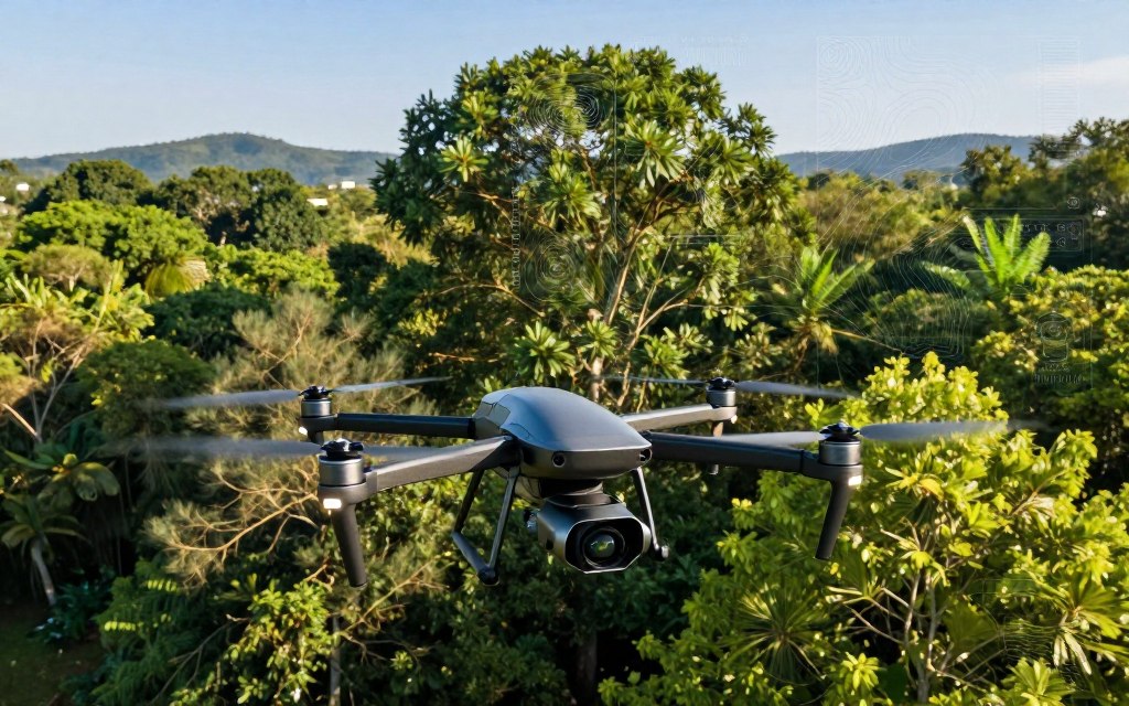
LiDAR data accuracy depends on sensor specifications, flight parameters, and calibration methods. Therefore, suitable processing techniques are essential for reliable results.
Unmanned Aerial Vehicles (UAVs) and Drones
Unmanned Aerial Vehicles (UAVs) and drones have changed how we capture and study spatial data. These flexible platforms can carry cameras, multispectral sensors, thermal sensors, and LiDAR systems. This versatility supports UAV mapping, aerial mapping, and many surveying uses.
Drone surveying and mapping usually follow several key steps:
- Mission Planning: Establishing the objectives and parameters for the flight.
- Ground Control Support: Utilizing ground control points to ensure accuracy.
- Image Capture: Collecting high-resolution images during the flight.
- Photogrammetry: Processing images to create 3D models.
- Orthomosaic Generation: Stitching images together for a comprehensive view.
- Quality Control: Ensuring data accuracy and reliability.
- Data Delivery: Providing usable spatial data to stakeholders.
Commercial and Industrial Drone Applications
Drones support many commercial and industrial uses, including these commercial drone applications:
- Construction progress tracking
- Mining operations
- Agricultural monitoring
- Power-line inspection
- Infrastructure assessment
- Insurance claims processing
- Public safety operations
- Real estate marketing
- Environmental surveys
- Disaster assessment
According to industry experts, “Drones provide a cost-effective and efficient way to gather data that was previously time-consuming and labor-intensive.”
Regulatory Considerations in the United States
In the United States, commercial drone operators must follow Federal Aviation Administration (FAA) regulations. These FAA drone rules include:
- Compliance with Part 107 rules
- Remote pilot certification
- Aircraft registration where applicable
- Operational limitations and airspace restrictions
- Adherence to privacy and local ordinances
It is crucial for operators to check current FAA requirements before flying. Regulations and airspace conditions can change often. Safety, data security, weather, battery life, operator training, and permissions to fly over people or restricted areas support successful operations.
Satellite Imagery and Earth Observation
Satellite imagery helps us understand changes across our planet. Earth observation satellites collect vast amounts of data. They support various sectors, including agriculture, urban planning, and disaster response.
Advanced sensors capture high-resolution images and measurements across wide areas, often with repeated coverage. This capability supports rapid assessments and long-term monitoring.
Major Earth Observation Programs
Several major programs and organizations collect and share satellite data. Notable examples include:
| Program | Provider | Key Features |
|---|---|---|
| NASA | National Aeronautics and Space Administration | Various Earth science missions, including Landsat |
| Landsat | U.S. Geological Survey | Long-term data for land use and change |
| Copernicus | European Space Agency | Sentinel missions for environmental monitoring |
| NOAA | National Oceanic and Atmospheric Administration | Weather and climate data |
| Maxar | Commercial Provider | High-resolution imagery for various applications |
Uses in Agriculture and Urban Planning
In agriculture, satellite data supports precision agriculture. It helps farmers monitor crop health, assess irrigation needs, and plan yields. Key applications include:
- Crop health monitoring
- Irrigation assessment
- Field boundary mapping
- Soil and moisture analysis
- Yield planning
Urban planners use satellite imagery to track land-use changes, development patterns, and infrastructure expansion. This data helps them:
- Identifying transportation corridors
- Analyzing heat islands
- Mapping impervious surfaces
Disaster Response and Humanitarian Aid
Satellite data is vital during emergencies. It supports disaster mapping through rapid assessments of affected areas. Applications include:
- Wildfire mapping
- Flood extent detection
- Storm damage assessment
- Earthquake response
- Refugee planning and access-route analysis
When ground access is limited, satellite imagery is essential for effective humanitarian aid.
Digital Mapping and Cartography Tools
Digital mapping has changed how we navigate and understand our surroundings. Moving from paper maps to interactive platforms improves how we view geographic data. Digital cartography combines geographic databases, map projections, symbols, geocoding, routing algorithms, and user interfaces for complete mapping experiences.
Evolution from Paper Maps to Digital Platforms
Cartography’s move from paper to digital formats has reshaped how people understand geography. Unlike static paper maps, online maps offer real-time updates and interactive features. These features let users calculate routes, display live conditions, and adapt web mapping platforms for personal or professional use.
Popular Digital Mapping Services
Several popular digital mapping services lead the field today. These include:
- Google Maps: Known for its comprehensive data and user-friendly interface.
- Apple Maps: Integrated with Apple devices, offering unique features like Flyover.
- Bing Maps: Provides detailed imagery and a range of mapping options.
- Mapbox: A developer-focused platform that offers customizable maps.
- HERE Technologies: Focuses on location data and mapping solutions for enterprises.
These services provide traffic information, transit directions, business listings, and terrain data for consumers and developers.
Open-Source Mapping Initiatives
Open-source mapping initiatives have grown in recent years. OpenStreetMap stands out as a collaborative project that lets users freely create and edit maps. Other tools include QGIS, OpenLayers, and Leaflet, helping communities and organizations use local knowledge for humanitarian response and research.
Open mapping offers major benefits but raises concerns about map accuracy, update delays, and privacy. Organizations wanting more control over their data can use these tools effectively.
| Mapping Tool | Type | Key Features |
|---|---|---|
| Google Maps | Consumer | Real-time traffic, Street View, and business listings |
| OpenStreetMap | Open-source | Community-driven, editable maps, free to use |
| Mapbox | Developer | Customizable maps, extensive APIs |
Indoor Positioning Systems (IPS)
Indoor Positioning Systems (IPS) help locate people and assets inside buildings. Unlike GPS, which uses satellite signals, IPS uses several technologies to find exact indoor locations. This matters in shopping malls, hospitals, and office buildings, where GPS signals may be weak or unavailable.
IPS and GPS use different positioning methods. GPS uses satellites, while IPS can use Wi-Fi positioning, Bluetooth beacons, and other methods to find locations. Building materials and layouts can affect signals, so IPS supports more reliable indoor navigation.
Applications in Retail and Healthcare
IPS supports many uses, especially in retail and healthcare. In retail, it improves customer experiences through store navigation and product discovery, helping shoppers find items. Retailers gain shopper analytics and inventory visibility, while location-aware promotions reach moving customers and increase engagement.
In healthcare, IPS helps track equipment and manage workflows. Hospitals can use it for wayfinding, helping patients and staff navigate complex facilities. It also supports room use, emergency response, and seamless asset management, improving resource control and overall operational efficiency.
Technologies Enabling IPS
Several technologies support the functionality of Indoor Positioning Systems. Bluetooth Low Energy beacons offer a low-cost way to track locations, while Ultra-wideband provides high accuracy. Radio-frequency identification (RFID) commonly tracks assets, and other methods include magnetic field mapping, inertial sensors, and camera-based systems.
When organizations implement an IPS, they must consider accuracy, installation costs, and interoperability. Battery life and cybersecurity also affect system performance. With responsible data practices and user consent, organizations can improve location services while protecting privacy.
Emerging Trends in Geospatial Technology
Geospatial technology is changing quickly through new trends. Artificial intelligence (AI) and machine learning drive many of these advances. They help process large amounts of imagery, sensor information, and location records.
Artificial Intelligence and Machine Learning Integration
AI in geospatial technology supports automated feature extraction, object detection, and land-cover classification. Machine learning geospatial analysis helps detect change and predict maintenance needs. These tools support traffic forecasting and disaster-impact assessments, helping organizations study patterns and make faster decisions.
Real-Time Data Processing and 5G Connectivity
Real-time geospatial data processing is becoming more important as 5G location services support connected vehicles and smart cities. These networks improve industrial monitoring and public safety, but they do not guarantee accurate insights. Results depend on data quality, network coverage, and system integration.
The Future of Geospatial Analytics
The future of geospatial analytics is bright, with digital twins and three-dimensional city models on the horizon. Cloud-native geospatial systems are spreading, improving data management, while geospatial foundation models and autonomous systems expand analysis. Responsible innovation remains essential as these technologies evolve, requiring action on bias, transparency, and data privacy.
Human oversight must remain a priority when geospatial predictions shape public or personal decisions. By fostering responsible innovation, we can use geospatial technology’s full potential.
Conclusion
Geospatial technology forms a vast ecosystem, not merely a collection of tools. Each component helps us: GPS positions us, GIS manages data for analysis, and indoor systems help where GPS falls short. Remote sensing and satellite imagery reveal conditions; LiDAR measures three dimensions, drones gather aerial data, and maps aid visualization.
The benefits of geospatial technology reach many sectors, including navigation, environmental protection, and agriculture. Navigation becomes more efficient; environmental tools monitor resources, and location intelligence helps optimize crop yields. Better planning and response improve transportation and public safety, while accurate data helps create sustainable urban communities.
Looking ahead, the future of mapping technology is promising. Advances in artificial intelligence, real-time data processing, and cloud computing will change how organizations use location intelligence. As we embrace these innovations, we must prioritize privacy, accuracy, security, and equitable access.
Doing so lets us use geospatial innovation fully and make informed decisions for a better future.